Athens from the E75
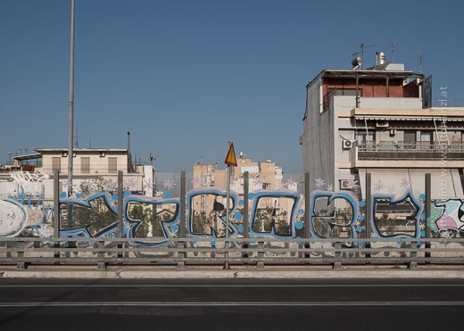
Athens from the E75
Typical Greek landscape
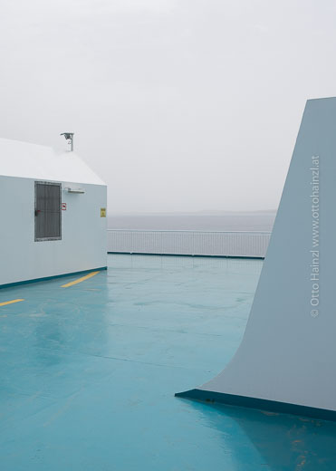
Piraeus
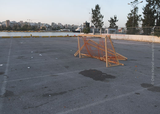
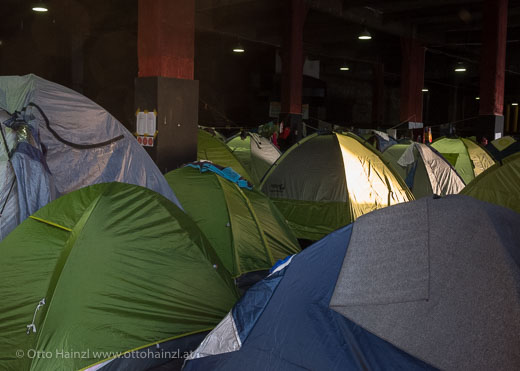
Early arrival. I go off in search of the cleared-out refugee camp—“along the wall at the port,” as I’ve read. There are still tents here, of course. It hasn’t been cleared out, even if the press reported that it was. Seven in the morning. All’s quiet. But I do see a few people. A large port facility parking lot with painted markings on the ground and concrete barriers. These attempt to determine a structure. I walk around. The tents. About 100, I think. Beside them an asphalted area with two goal cages made of wood and orange netting. Well done. Football. Quiet still prevails.
A couple of campers are parked here. For the assistance efforts. There’s a paper sign that reads “Doctor” taped to one of them. Things generally seem organized, but the available resources are modest. Alongside the large building there are portable toilets, around 20 of them. And now I see the building’s entrance. It opens onto a whole warehouse full of tents, chock-full of tents. A couple of voices can be heard—but they can’t overcome the morning’s quiet. There’s a strong smell in the air. A bulletin board is covered with sheets of information on how to continue. Where to go—or not to go. In Arabic, in Farsi, and in English. The sun’s coming up. From now on, the outdoor tents will be at the mercy of the day’s heat.
Then I speak with a refugee and ask him how long he’s been at this camp. Two months—too long. He wants to continue on to Italy, where his family is. He knows the route. But he’s still sitting around here. I talk with a volunteer helper, a young man from Romania. “We help with food, chai and love. That’s what we can do.” He gets back to work.
This is one of two refugee camps here in Piraeus. It houses around 1,000 refugees, while the other holds more than 5,000. It provides help, but it wasn’t set up by the state.
.
What Europe am I driving into, anyway?
I got the idea for this project several years ago. When I realized just how extensive the Europastrasse network is, even running into such roads in Asia, and when it became clear to me just how unclear to me and many others the underlying idea is, I decided to drive one of them from A to Z. But, “The map is not the territory.” What I’m learning about here is our continent, us.
Vardø has caught my interest. A village at the end of the world. Or that’s how it looks from my perspective, at least. (I admit that I often view the earth as being a flat disc.) And it’s to just this end that a certain Europastrasse leads. Why? At this road’s other end is Sitia, on Crete. Which is probably a bit better known, but I’m no more familiar with it. If it’s not at the end of the world, it’s at least at the end of Europe.
So the E75 becomes my Europastrasse of choice. I really like how, in running from north to south, from south to north, it traverses the entire continent and so many cultures that touch our own. Sitia, one of Europe’s southernmost points. Farther south than the Straits of Gibraltar, farther south than Sicily. Vardø, on the other hand, is a good ways north of the Arctic Circle, Continue reading
Arctic Circle calling!
Today I start driving the Europastrasse E75. Off to Vardø, off to the Arctic Circle and the Arctic Sea.
Here we go. Right now!
The authorities investigate
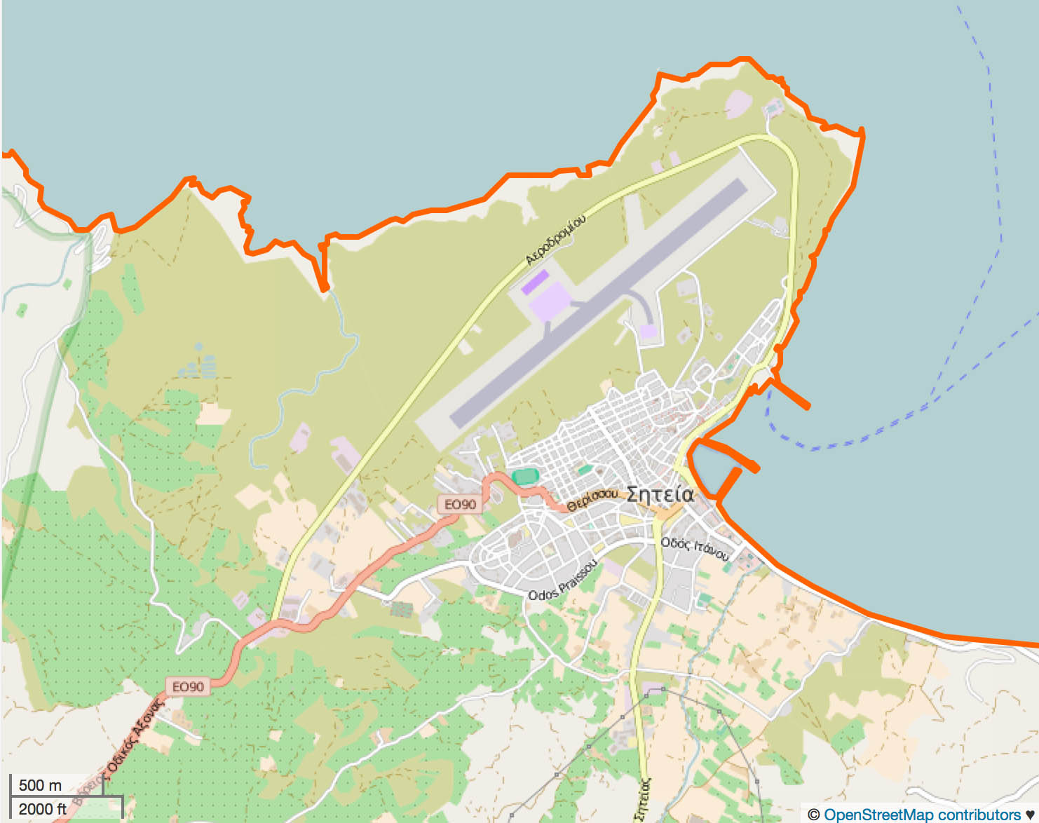
So I went to the local port authority to learn more about my starting point and route. After a few discussions, it becomes clearer: the E75 probably leads around the airport. But just to be sure, I’ll drive both routes so that I don’t get off on the wrong foot. I should add that “probably” is my word. The folks at the port authority, who also put in a call to the police, were pretty sure. More on that later. My question: where is it all written down in black and white? We’ll believe Google, but Google is just second-hand information—we should remember that.
And I realize: The E75 is something dynamic, like all other Europastrassen. They change constantly—that surprises me a bit.
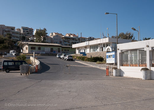
Probably starting point of the E75: at this gate.
Where does it actually begin?
Today, the first serious problems became evident. Where does the E75 begin, and how does it run??? So I ask openstreetmap.org, here.com, and of course Google Maps. Three different mapping services, three different answers. One says it runs right through the town, one says it goes around the airport, and a third says both stretches of road are the E75. So what to do? Will my project fail already in Sitia? :-//
Whenever you consult the cards, they tell you only what happens when you give yourself over blindly to fate (tarotwissen.de).
There are no longer any printed maps here, by the way.
Arrival
When I arrived in Sitia yesterday, driving into town after having traveled about 2,500 km, I had the feeling that I’d finally reached my destination. Until the realization came that I’d only arrived at the planned origin. There are palms all over the place, here, and I’m going almost to the North Cape. :-//
How to put a car on a boat
How to put a car on a boat in order to reach the E75.